
EOS Crop Monitoring digital agri platform will provide comprehensive information on any farmlands
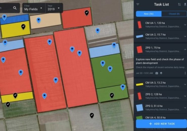
Image: EOS Crop Monitoring platform interface. Photo: courtesy of PRNewswire / EOS Crop Monitoring.
EOS Earth Observing System has introduced its digital agri platform for the customers in the North American market.
EOS Crop Monitoring is a digital agri platform that combines AI, satellite vegetation images and weather data to provide deliver comprehensive information on any farmlands.
EOS Crop Monitoring digital agri platform for farmers
The digital agri platform allows farmers, insurers, traders and other subject matter experts to use satellite imagery for the betterment of their business.
The platform combines satellite images captured by the current main satellite missions and processes large amounts of information via AI-driven algorithms. Later, it presents the results through an advanced UI.
EOS Crop Monitoring uses normalised difference vegetation index (NDVI) and others such as ReCl, NDRE, CCCl, and MSAVI.
The digital agri platform determines field borders and offers historical weather reports for the past ten years, enabling to compare median yearly temperatures and precipitation as well as measuring of accumulated temperature.
EOS Crop Monitoring also provides a five-day forecast, helping to send alerts to users regarding upcoming disturbances such as intense drops or spikes of temperature.
Based on the territorial layout of the landbank, the cost advantage of this technology together with the complete suite of precision agriculture can vary between 5% and 20%.
EOS Crop Monitoring CSO Alexander Sakal said: “Agriculture has never been easy, but the farming conditions are becoming more and more complicated. The global resources are stretched while the population is growing. This is why implementing technology-based solutions is crucially important.
“We want to help agri entrepreneurs from all around the world to achieve better results by wasting less, getting more, and becoming more sustainable in general. Basically, we suggest a set of tools to benefit everyone — the user, the consumer and the planet.”
Based in Menlo Park of California, EOS is an international satellite data analytics company that offers satellite imagery analysis with 0,40m-2,00m resolution. It collaborates with major orbital missions, including Landsat, MODIS and Sentinel.